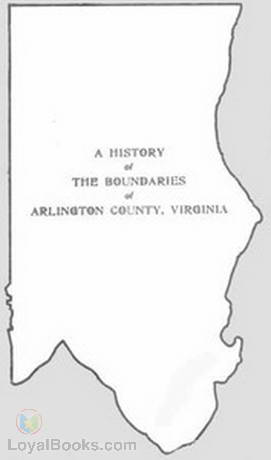
A History of the Boundaries of Arlington County, Virginia By: Office of the County Manager |
|---|

In "A History of the Boundaries of Arlington County, Virginia" by the Office of the County Manager, readers are taken on a journey through the intricate evolution of this remarkable region's boundaries.
The book presents a comprehensive account of Arlington County's territorial transformations, offering a wealth of knowledge for history enthusiasts, locals, and scholars alike. It delves into the factors behind the formation, modification, and redrawing of the county's boundaries, shedding light on the political, social, and economic forces that shaped its development over the years.
One of the book's greatest strengths lies in its meticulous research and presentation of original documents, maps, and photographs. These visual aids enhance the reading experience, enabling readers to visualize Arlington County's past and better understand the significance of its changing boundaries. The inclusion of these primary sources lends credibility to the historical narrative and invites readers to engage with the material on a deeper level.
The authors successfully navigate complex topics such as land disputes, annexations, and boundary adjustments, providing a well-structured and clearly written account that is accessible to readers from various backgrounds. They strike a commendable balance between providing detailed explanations and maintaining a readable pace, ensuring that even those unfamiliar with the intricacies of boundary history can follow along.
Readers will appreciate the book's attention to contextualizing the significance of boundary changes. The authors take great care to highlight the impact of these modifications on both local communities and broader historical events. Additionally, they skillfully interweave anecdotes and personal stories, offering a human dimension that makes the historical account all the more engaging.
While "A History of the Boundaries of Arlington County, Virginia" provides an impressive amount of information, some readers may find that it leans more towards an academic approach rather than a narrative-driven style. The wealth of names, dates, and technical terminology may occasionally overwhelm those seeking a more casual read. However, for readers interested in deepening their understanding of Arlington County's history, especially from a geographical perspective, this book proves to be an invaluable resource.
Overall, the Office of the County Manager has produced a commendable account of the complex and often overlooked topic of boundary history. "A History of the Boundaries of Arlington County, Virginia" is an essential read for anyone fascinated by the evolving boundaries of regions and how they shape the communities residing within them. The book's meticulous research, thoughtful analysis, and comprehensive scope make it an authoritative reference for those seeking a deeper understanding of the rich history of Arlington County. THE BOUNDARIES of ARLINGTON COUNTY, VIRGINIA Office of the County Manager Arlington, Virginia 1967 [Illustration: THE BOUNDARIES OF ARLINGTON 1791 1801 1846 1870 1875 1915 1929 1936 1946 1966] FOREWORD TO THE SECOND EDITION This collection of documentary references to the boundaries of Arlington County was first published in 1957. This new edition contains revisions made in the light of fuller knowledge, and brings the story up to date by taking account of the change in the common boundary with the City of Alexandria which went into effect on January 1, 1966. This pamphlet can serve as a guide for those who need to know what jurisdiction covered this area at any particular time. It provides information for the student as well as the title searcher in fact, for anyone interested in the history of what is now Arlington County. [Illustration: Signature of Bert W. Johnson] Bert W. Johnson County Manager A History of The Boundaries of Arlington County, Virginia TABLE OF CONTENTS Page Introduction Arlington County Today 1 1608 1789 2 The Charters of James I to the... Continue reading book >>
|
| eBook Downloads | |
|---|---|
|
ePUB eBook • iBooks for iPhone and iPad • Nook • Sony Reader |
Kindle eBook • Mobi file format for Kindle |
|
Read eBook • Load eBook in browser |
Text File eBook • Computers • Windows • Mac |
| Review this book |
|---|